What To See and Do at The Chiricahua National Monument, Arizona
If you’re around Willcox, AZ or looking for a trip that will make you feel like you’re traveling back in time, Chiricahua national Monument is a wonderful place to start when exploring all of the beauty Arizona has to offer.
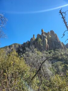
Chiricahua National Monument, Coronado National Forest and the surrounding areas in Arizona are full of culture, history, amazing views, and rock formations that will have you wondering just how they stay the way they are…or when will some fall!
Welcome to The Chiricahua National Monument
When traveling on Interstate I10 between Lordsburg, New Mexico, and Tucson, Arizona, take exit 336 to Haskell Avenue/I10 Business into Willcox, AZ, and follow the signs to Chiricahua National Monument.
On your way down Haskell, stop in and say “Hey y’all from Vince and Lesley!” to the locals at the Cattle Rest RV Park and Saloon. This is a good place right off the interstate to stay if pulling your RV or check out their Airbnb right next door. They offer a small menu of food, drinks from the bar, pool tables, dart board, and shuffleboard, too. Certain nights are busier with live entertainment and pool tournaments, too.
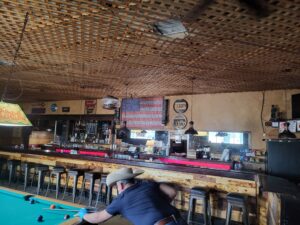
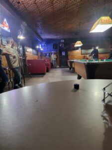
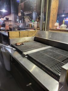
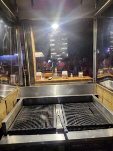
Just a little further down the road, you’ll find Rix’s Tavern where you can grill your own steak, pork chops, hamburger and so much more, right inside! It has options for a baked potato or salad bar and the beans are always free! Make sure you tell them we sent you and they are missed! There is Willox Laundry right next door, also. You can eat or play a game of pool at Rix’s while waiting for your clothes to wash and dry.
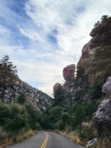
Now get on down the road and check out the beautiful scenery along the way to the Chiricahua! You may want to pack a snack or lunch since there are no services after Willcox.
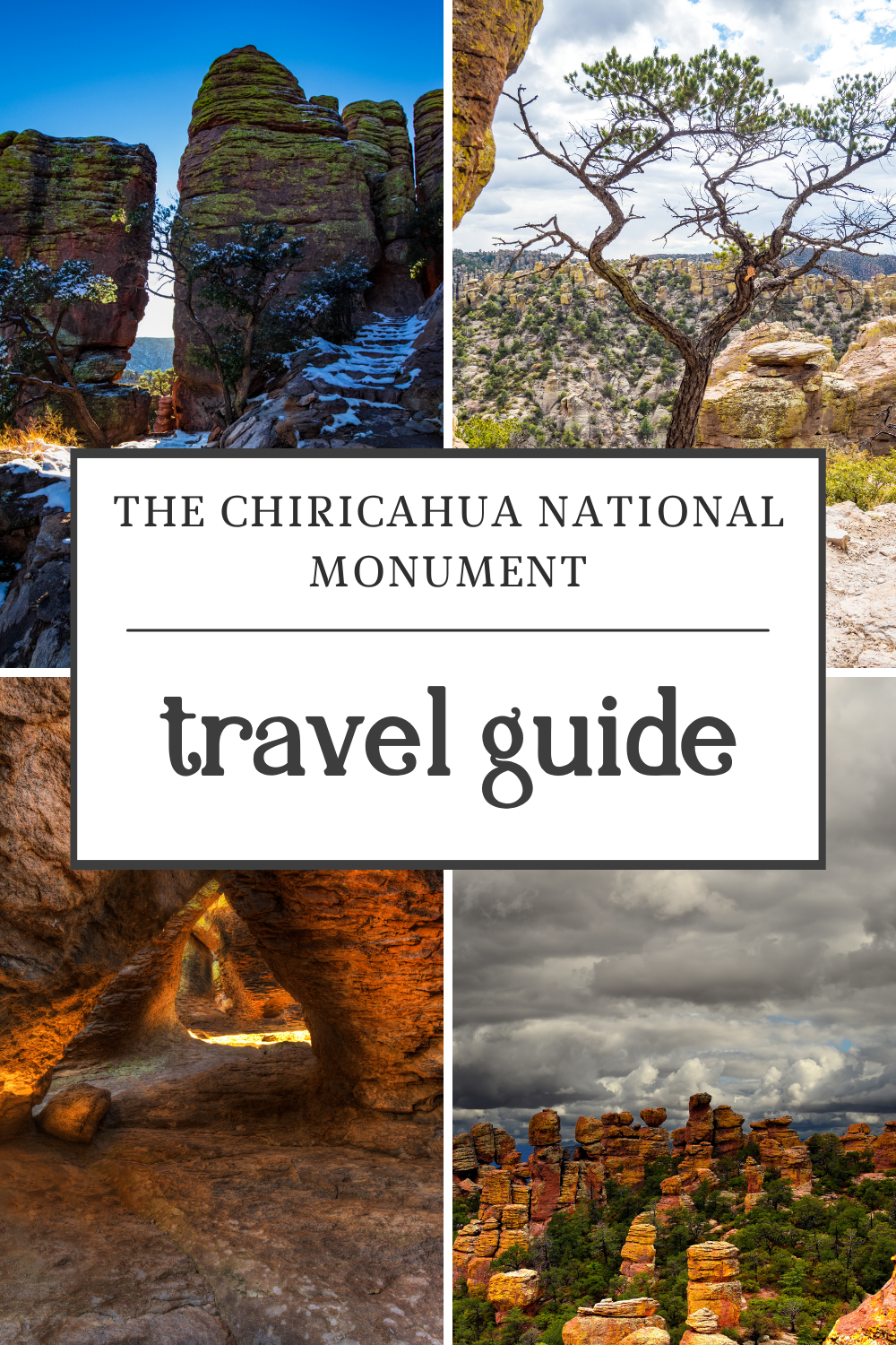
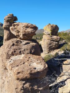
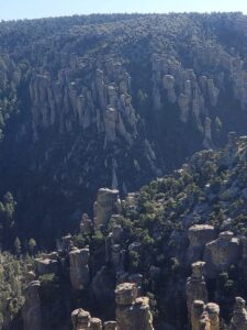
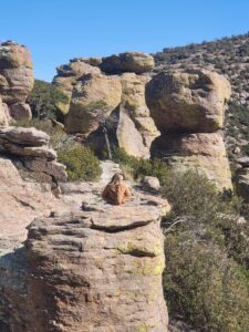
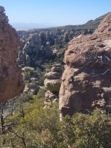
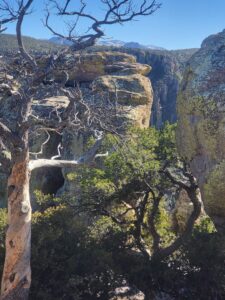
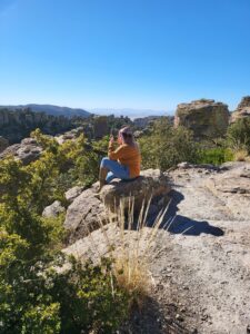
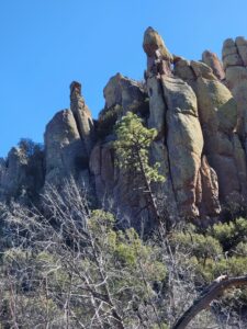
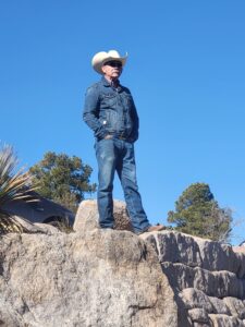
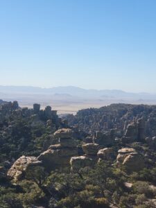
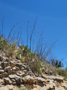
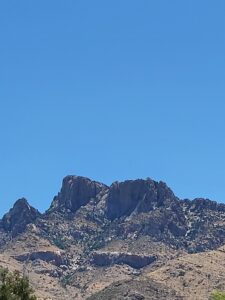
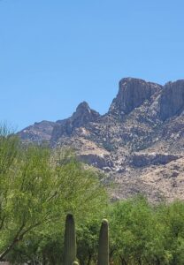
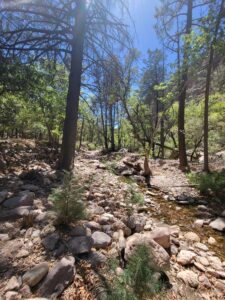
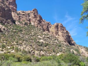
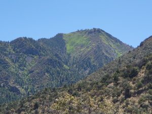
The scenery of the Chiricahua National Monument
Once you pass through the visitor center, keep your camera handy, and drive slowly with the windows down to experience all the birds singing their songs. If you’re lucky, you may just spot a turkey or two! The Chiricahua are home to a wide variety of birds since Arizona, along with California, New Mexico, and Texas are considered a “funnel” when birds migrate from Mexico. You may spot the elegant trogon or the magnificent hummingbird. There are thirteen species of hummingbirds that are known to occur in the Chiricahua Mountains, and many of these are Mexican species that are rarely seen in the United States. In all, there are around 200 species of birds that have been documented in this area, making it a great stop for both the serious and casual birder!
As you can see from the pictures below, it makes for a great day trip for a family with so many beautiful areas to discover.
The Chiricahua National Monument History
The Chiricahua National Monument has a history beyond our realm of comprehension and was once named Bonita Park. It was first the land of the natives. Starting around 1870 with the first known white settler, Louis Prue then Tom and Mary Bridger around 1902. In 1880, the Stafford family went to Bonita Canyon and built the first cabin. It ended up being purchased by the Eriksons of the Faraway Ranch in 1918. Lilian Erikson Riggs, along with her husband Ed Riggs, advocated to protect the Chiricahua National Monument. Somewhere around 1886, the 10th Calvary Troop I, also known as “Buffalo Soldiers”, was stationed at Bonita Canyon, before heading to Fort Verde, AZ.
The monument was established in April of 1924 to protect the hoodoos and balancing rocks that were created 27 million years ago by one of the largest known volcanic eruptions in the American Southwest. This wilderness holds spiritual and cultural significance for those that called it the Land of Standing Rocks, the Chiricahua Apache.
The Chiricahua Apache
In the 1800s, a local to the Chiricahua Mountains, Chief Cochise was the leader of the Chokonen band of the Chiricahua Apache. In 1861, the Arivaipa band of Apache raided the farm of settler John Ward and were seen heading toward the Chiricahua Mountains, known to be Cochise’s territory. This tribe was not part of the Chiricahua. Lieutenant Bascom, joined by Chief Cochise and some of his family, in Butterfield Stage Station on Apache Pass, was accused of the raid. They were held captive. Cochise escaped, but unfortunately, his brother and other family members did not and were killed.
A year later, along with his father-in-law, Chief Mangas Coloradas, Cochise assembled the largest war party of the Apache Wars. After a long 24-year battle, Chief Mangas Coloradas lost much of his will to fight after the Battle at Apache Pass. After being invited into negotiations at Fort McLane in New Mexico, he was killed. The loss of Chief Mangas led Cochise to take up leadership of the Chiricahua. Capturing or defeating Cochise now became the key to U.S. victory.
Chief Cochise
Chief Cochise began to operate primarily from the impregnable mountain rock formation known as Cochise Stronghold in the Dragoon Mountains. Tall rock spires allowed lookouts to see anyone approach from far off. Hiding spots allowed for an easy ambush. The Stronghold was never taken. The Chiricahua people were more adapted to the land than the US soldiers would ever prove to be.
Even though Chief Cochise was repeatedly asked to meet and discuss relocating his people to a reservation, he always refused. Reservations at the time had poor conditions. After some time, Cochise befriended a white man, General O. O. Howard, and came to an agreement with him for the Chiricahuas. Cochise procured a reservation for his people that spanned much of modern-day Cochise County in southeast Arizona with no roll call. They were able to roam free and camp wherever they wanted. They were even allowed to leave the reservation, and often raided in Mexico, which stirred tensions. The reservation seemed to have brought about a peaceful period of war that lasted 4 years.
After Cochise’s death in 1874, the US government saw a chance to close the problematic Chiricahua Reservation.
Clum, Geronimo, and the Chiricahua Reservation
John Clum became an agent for Sans Carlos Reservation. He traveled to the Chiricahua Reservation to order all the Chiricahua people to the San Carlos Reservation. He met with Cochise’s son, Taza, Juh, whose brother-in-law often spoke for him because Juh had a stutter. Juh’s brother-in-law’s name was Goyakla, also known as Geronimo.
Geronimo instigated a disagreement between Taza and Juh (pronounced WHO) and led two-thirds of the Chiricahuas off the reservation. This broke the agreement with Clum. Geronimo was outsmarted and captured by Clum at the Ojo Caliente Reservation. Clum took Geronimo back to San Carlos where he hoped to put him to death, but Geronimo’s luck ran deep. Because in Washington, D.C. the Bureau of Indian Affairs and the Department of War were still fighting over jurisdiction of the Chiricahua Apache and could not reach a decision on Geronimo’s fate. Geronimo sat in shackles before his release. He stayed on the San Carlos Reservation for a few days before deciding to leave before his sentence could be finalized.
Geronimo’s surrender
After another long war spreading over 24 years between the Chiricahuas, Apache, and Mexico, it ended with Geronimo surrendering to LT Gatewood stating “Once I moved about like the wind. Now I surrender to you and that is all,” Geronimo said.
Their people were captured and promised a good life on their soil, but instead, they were put on a train. Some were sent to Florida, while others were sent to Oklahoma and Alabama.
The story of Cochise, The Chiricahuas, and Geronimo was one of determined people to remain where they were, where they grew up, and knew the land like the back of their hand. The US Government pursued these tribes relentlessly all for the sake of taking their land, which oil was discovered. This land was never to belong to the US Government. It should have remained as was! Thanks to those that preserve it!
Artifacts
This place isn’t just beautiful but full of history. Artifacts are still being found daily and used to “put things in chronological order.” Please be mindful of carrying anything out you may find.
Please, take the time to do your own research on the history of the natives of this country, also.
While there, take your time to follow the trails. Check out the areas to pull over and stay on the main road up to the lookout. Bring your camera and a jacket and take all the time possible to enjoy the views and lookouts!
There are plenty of camping spots all around there, also. Check out their website for locations, costs, and rules.
Like us, you’ll mark this area as one of your favorite adventures. Can’t wait to hear all your findings. Enjoy!
As always, keep it between the mustard and the mayo!